


The Central Highlands of Peru receive a fraction of the tourists that head to the southern cities of Cusco, Arequipa and Puno. Further north, Ayacucho was off-limits not so many years ago, thanks to the activities of terrorist organisation Sendero Luminoso (Shining Path). Today, this gritty city is safe to visit, but it’s still largely unknown to international tourists – the vast majority of those who holiday here hail from Lima, an hour away by air.
Ayacucho
Ayacucho reminded me of Cusco three decades ago. Shoe shiners still pulled out their little wooden stools; D’Onofrio ice cream was sold from the back of a yellow trike just as I remembered, though the guy killed time playing on his phone.
The well-heeled watched all the comings and goings from the first-floor balconies of the cafés that lined the Plaza de Armas. Most travellers still fixed up excursions on arrival, and an agency tucked away in an alley sorted me out with everything I asked for in exchange for a fistful of soles.
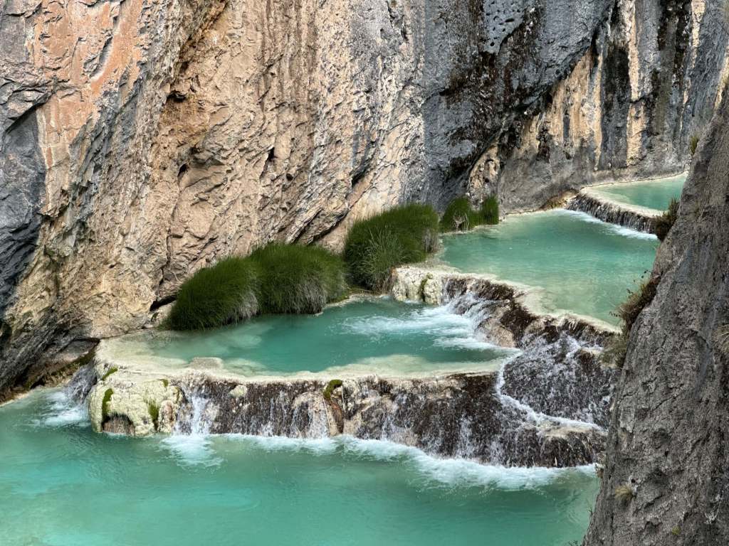
I began with a day out at the turquoise pools of Millpu. Organised tours here began just a decade or so ago; so legend has it, this is the devil’s throat and so superstitious locals used to keep their distance. But this narrow canyon and its colourful stepped pools are so photogenic that it was inevitable the Insta-generation would discover it eventually. Already, bathing in the water has been banned for ecological reasons and visitor numbers are strictly controlled. But hiking amid such breathtaking scenery was more than reward.
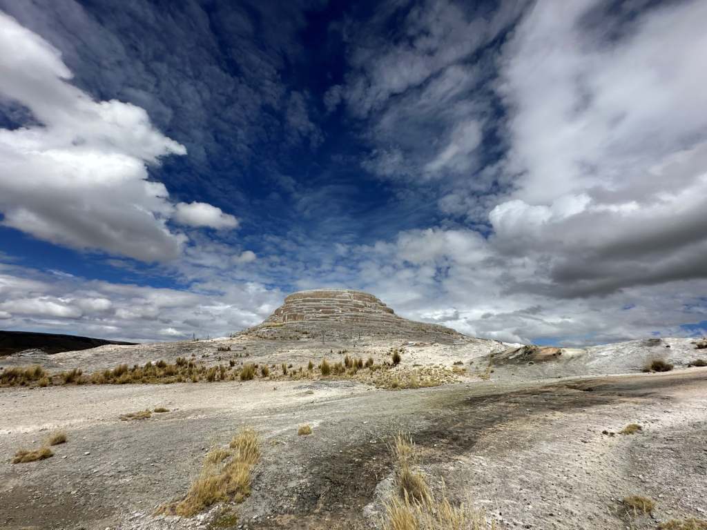
Pachapupum
I was also excited to see Volcan Pachapupum (the name means “navel of the earth”). To reach it involved another long drive from Ayacucho along alarmingly narrow mountain roads which were strewn with rocks loosened by recent rainfall.
Herds of alpacas and the occasional waterfall provided a distraction from the driver’s worried tutting and furrowed brow. Pachapupum, when we finally reached it, was almost deserted. Technically, it isn’t a volcano at all and has been created by deposits left by the area’s mineral-rich water, but that doesn’t make it any less impressive. Surrounding this rock formation is a cluster of hot springs; though you can bathe here, the idea didn’t sound entirely inviting in the chill winter wind. Instead, I pulled off my hiking boots, stripped off my socks and settled for a foot soak instead.
This part of Peru doesn’t boast the Inca ruins that litter the south, but was home to a much older civilisation. The Wari Empire spanned a 400 year period from about 600AD. There’s an interesting archaeological complex just 14 miles from Ayacucho which is ideal for tourists seeking a potted history of what the Wari achieved and a glimpse at some of the stone and mud structures that have been unearthed. Though it doesn’t have the jaw-dropping qualities of sites like Machu Picchu, Sacsayhuaman or Ollantaytambo, it’s proof that the Incas weren’t the first to leave their mark.
Laguna de Pacucha and Pampachiri
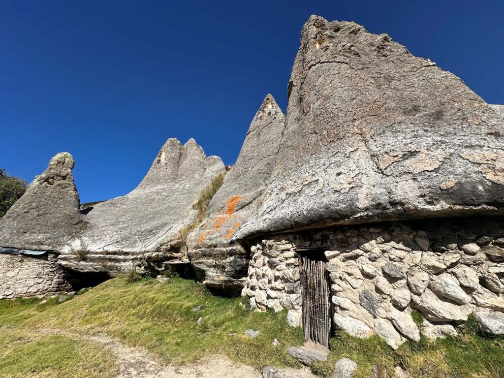
I was lured out of Ayacucho by the promise of lakeshore glamping overlooking tranquil Laguna de Pacucha near Andahuaylas. Though I could have happily watched the changing light play on the water all day (especially during the fabulous sunrises and sunsets) I arranged for a local driver to take me to Pampachiri. I wanted to see its so-called Smurf’s Houses. These ancient homes had been carved out of solid rock and look strikingly similar to those in the cartoon. Save for a couple of locals, a dog and three pigs rolling in the dirt, we had the place to ourselves. Nearby, the Bosque de Piedras was a forest of rock pinnacles, the result of a volcanic eruption that happened four million years ago. Again, there was no one in sight. Under a cloudless cobalt blue sky, the silence was heavenly.
Yungay
To save myself a torturous two-day journey on multiple boneshaker buses, I hopped on a flight back to Lima to connect with another that would deliver me to another mountain hub: Huaraz. Leg two didn’t go to plan. Unfortunately, strong cross winds on the final approach necessitated a go-around and before long, we found ourselves back on the tarmac in Lima. After a two-hour wait, the captain informed us we’d been cleared to have another go and this time, the landing was successful.
Extensive roadworks in downtown Huaraz limited its charm, so after a quick nose around I decided to concentrate my efforts on seeing the surrounding countryside. One place that had long been on my radar was Yungay.
In 1970, an avalanche of ice, rock and debris completely engulfed the town. A 7.9 magnitude earthquake that shook nearby Mount Huascarán had triggered it. More than 70,000 people lost their lives in the tragedy; all that remained was a statue of Christ and four palm trees. The memorial that was erected to mark that devastating event is a poignant reminder of how vulnerable we are when Mother Nature does her worst.
Chavín de Huántar
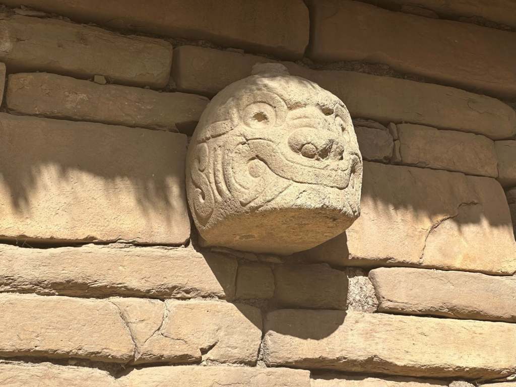
Peru’s long and multifaceted history provided the focus for my next day trip, which was a visit to an archaeological site called Chavín de Huántar. It was once an important religious centre and the sprawling complex of plazas and passageways (some underground) was rich in symbolism and ornamentation.
Our guide told us that the Chavín people flourished around 2,000 years ago, but they probably settled here more than a thousand years before that. Not only does that mean they predated the Incas, but it’s now thought they inspired their famously precise mortar-free stonework and trapezoid doorways.
Pastoruri Glacier
On my last day in Huaraz I opted to take a guided excursion to Pastoruri Glacier.

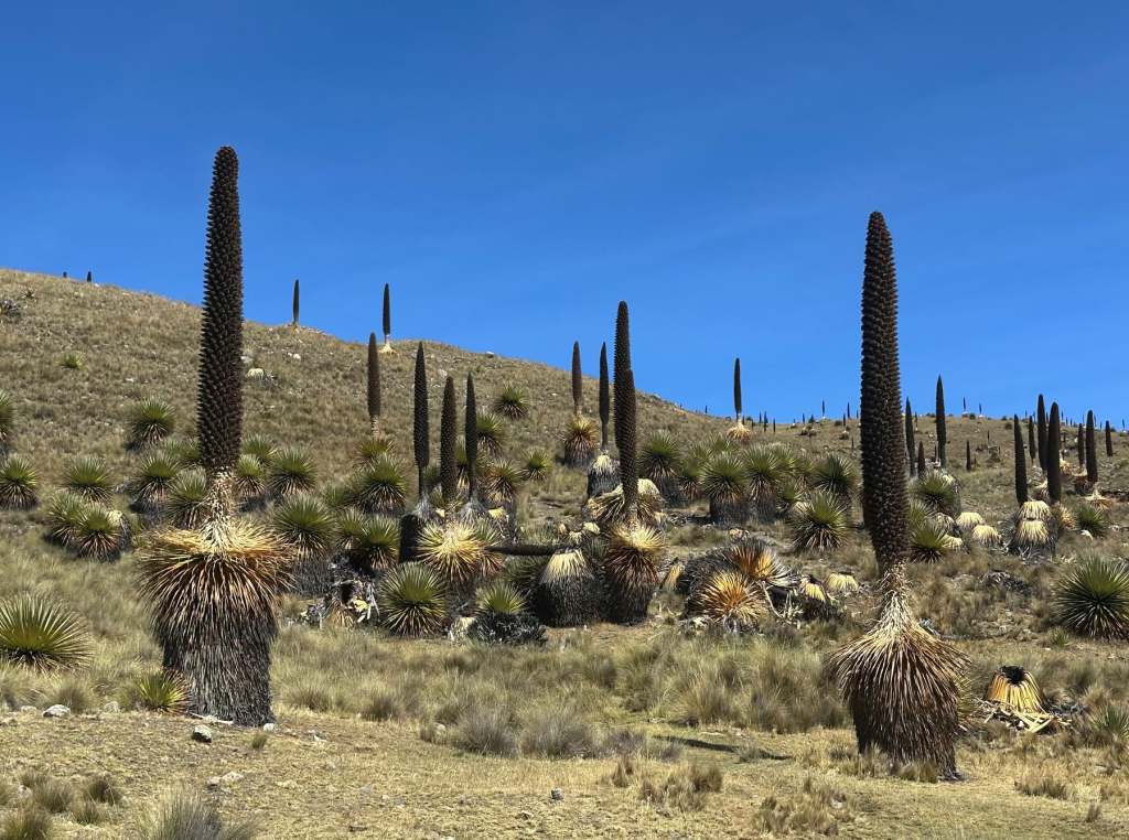
We stopped on the way to admire some rather curious plants. The Puya raimondii is an exceptionally large bromeliad that can grow to 15 metres in height. Its nickname, the Queen of the Andes, was justified as it certainly commanded attention, especially where it grew in clusters.
Pastoruri, a remarkable tropical glacier, sits at 5,240 metres above sea level; the highest I’d ever been. Sadly, this body of ice is retreating at an alarming rate; within a few years the only evidence of its past existence will be the now steadily-growing lagoon.
For now, there’s sufficient ice to make the trip worthwhile, but hiking up was no walk in the park. Barely out of the van, enterprising locals were collaring breathless tourists like me with the offer of a horse. I was quick to accept; riding up was a lot easier on the lungs and gave me a chance to take in the extraordinary mountain scenery. Regardless, the final stretch is completed on foot; even that took far longer than I’d imagined. But the view, like so many in this part of Peru, was worth every laboured gasp.
Getting to and around the Central Highlands of Peru
Currently there are no direct flights from London to Lima. Many travellers connect via Amsterdam, Paris or Madrid, though it’s also possible to fly via US hubs such as Miami or through Bogota, Colombia. Peru’s size means that internal flights are a time-efficient means of getting around; I flew with Sky Airline to Ayacucho and LATAM to Huaraz. Long-distance buses are a cheaper option, though often services operate overnight. Self-drive itineraries are challenging on poorly-maintained mountain roads especially after rain; instead negotiate a daily rate with a local taxista or reserve a place on a group tour.
Avoiding Altitude Sickness in the Central Highlands of Peru
Visitors should approach Peru’s highland areas with caution because of the risk of altitude sickness. Lima sits at sea level, but Ayacucho is at 2,761 metres and Huaraz is at 3,052 metres. Many excursions venture higher still. Allow yourself at least a couple of days to acclimatise. Take it easy. Drinking the local coca tea can help. Build up gradually if you’re planning to exert yourself, saving the most challenging hikes for later in your trip.
Ancient Sites of Peru
Peru is blessed with many historical sites, read our round up of the ancient Peru sites away from Machu Picchu.